Back to the report
of the September 2006 expedition
Cette
page en Fran?is... cliquez ici
Where did that big
inlet go to? To the Gouffre des Partages? And how did the Galerie
Terranef continue? Did it go through fossil levels to the Gouffre
AN8, or did it provide an access to the river that we had lost in
the terminal sump of the Haddock river? And what about the
Rantanplan network, that had only been superficially explored and
where at least 10 side-passages awaited exploration and surveying?
And that damned clinometer? the survey of the upstream part of the
Haddock river, in September, had showed a serious problem with this
instrument, that had been used intensively in August as well. So,
how reliable where the surveys? How could I possibly draw a decent
survey of the cave System?
So many questions and
problems. We couldn?t wait another year to get answers: we had to go
back there, ASAP!
In the week of November 1st,
a Holiday, we had the time to go back, but it was a big gamble: that
time of the year, snow and heavy rain was very likely and the
expedition would be totally impossible then. But the weather gods
where at our side: we had a whole week of beautiful and even warm
weather. The team was 5 persons strong: Annette Van Houtte, Bart
Saey and Paul De Bie (SC Avalon, België, Patrick G? (MASC, Fr) and
Eric Boyer (MJC Rodez, Fr.)
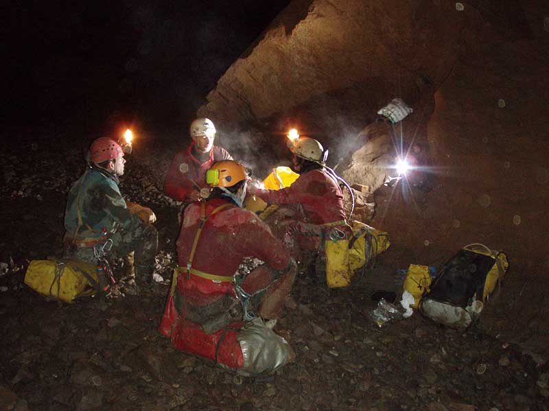
On our way to the camp at -575m (photo Eric
Boyer)
The five of us arrived
Monday evening around 18:00 in the underground camp in
Salle des Marsupilamis at ?575m, tired after having progressed
through the cave for many kilometres, carrying heavy tackle bags.
While Annette decorated the camp with paper chains, so that we could
celebrate Halloween, Patrick and Eric went to Salle Gargamel to dig
(in vain) in an interesting side-passage.
Tuesday
we left the camp at 10:00 in the morning. We split up in two
surveyteams and worked all day long exploring and mapping. The many
side-passages of Galerie Rantanplan yielded over 350 m of new
passages, and resulted in a map that looked much like a tray of
spaghetti: very complex. The Galerie Yoko Tsuno, a big and
decorated lower level of Rantanplan was surveyed over 165m, and its
fantastic formations were photographed.
We remeasured and
round-tripped Salle Sidonie, and this gave us the confirmation that
the bad clinometer had functioned correctly in August: ouff! That
evening, we stumbled back into the camp near 20:30, tired but with
over 700 m of new passages in the survey books. We weren?t very
fresh anymore, especially returning through the Puits des Daltons is
a killer: a series of narrow pitches, sharp meanders and severe
squeezes. Belgian caving, in other words. The evening was very
nice and cosy, all kinds of alcoholic drinks helped chasing the
biting and damp cold of our hostile environment.
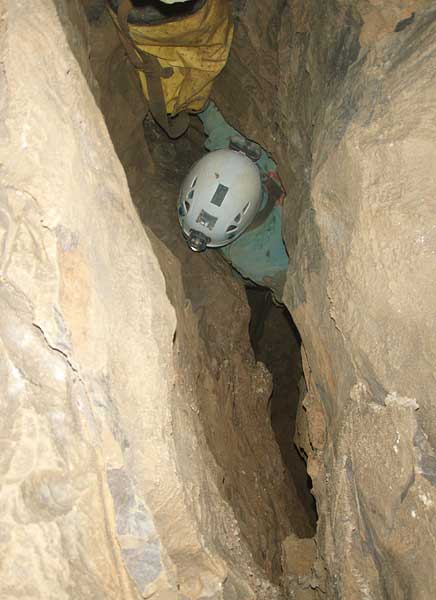
Belgian caving (Puits des Daltons, photo
Eric Boyer)
Wednesday
we woke up even earlier and it wasn?t even 9 o?clock before we were
already on our way to the exploration zone that was at least two
hours away from the camp. We had big plans! After Rantanplan and
Salle Sidonie, Patrick and Bart entered territory that was new for
them: the impressive Galerie Vaillant, the cosy Salle Sophie and the
unforgettable arrival at the balcony of Salle Castafiore, in which
the river roared.
Our goal was the exploration
of the big inlet, which we baptized Rivière Tintin. It began rather
low (1m50) but wide (8m). About 100 m further the dimensions had
changed to an impressive 15 m wide by 5 m high and that giant tunnel
seemed to go on forever! Beautiful formations, a river tumbling
down small waterfalls and flowing over bedrock of schist or
zigzagging between beaches of gravel, and a lot of air draught
blowing towards us: all ingredients were present to make it an
unforgettable exploration. Another inlet was seen and visited over
30m, it continues.
Everyone was euphoric, this
wasn?t an ordinary, everyday exploration! But every fairytale ends
and in this case it was a sudden low duck that stopped us, where the
water was 1m30 deep and with only 20 cm of air. Nobody wanted to get
wet in the freezing cold water. Next time, with a ponto or a
neoprene suit we will take a look there. Both teams started mapping
like crazy and much to our surprise, a few hours later, the job was
already finished: the Tintin river was 721m long? not bad!
That afternoon we resurveyed
the Haddock River again, only the upstream part for which we had
used a defective clinometer in September. And to finish the day in
beauty, a new and shorter access to the Haddock River was discovered
and mapped (a 12 m pit near the beginning of Galerie Vaillant) .
The downstream part of the cave, towards the AN8 Cave was not
further explored: of course it will be one of the main objectives in
2007!
We arrived in the camp
around 21:00, in a euphoric mood but yet a bit ?broken? by this long
and again tough day. Traditionally, each member had taken a small
bottle of ?something? down to the camp and so we celebrated our
discoveries with hot wine, Turkish Raki, Ratafia from Aveyron,
Scottish whisky and J?ermeister. Our dry-food tasted better than
ever.
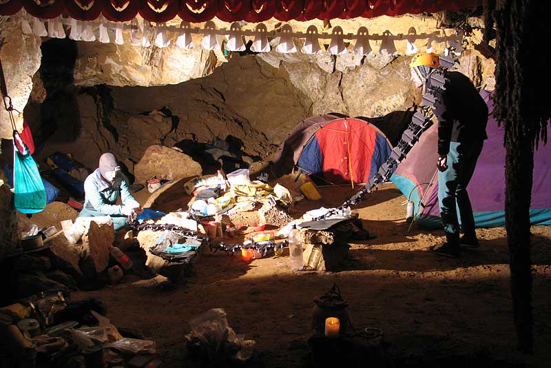
Halloween mood in the camp (photo Paul De
Bie)
Thursday:
we return back to the civilization outside. We arrive at the surface
just in time to see the sun going down, as always a magical moment
after 4 days of cold and darkness. The walk down to the ski-station
had to be done in the dark, over a moonlit lapiaz. Despite the
heavy rucksacks, the fatigue and soar muscles, we enjoyed this walk
a lot?
Late that evening we quickly
entered the survey data from the Tintin river into the portable PC.
And our jaws dropped when we saw were it headed to: not the the
Gouffre des Partages, but plain East, with the terminus only a few
dozens of metres away from? our very own Anialarra river, before the
terminal boulder choke! So, was Tintin nothing more than a branch
of the Anialarra main drain? And could it be connected to it, which
would open a real ?freeway? that would make it possible to reach our
exploration zone in only 45 minutes, instead of several hours? It
would even no longer be necessary to go through the boulder choke,
risking our lives. We?ll see, in 2007!
Bart in Galerie Yoko Tsuno (photo Paul De
Bie)
Conclusion
It was again a great
expedition. The Belgian-French team proved once more to be a winning
combination. And, after all, Antwerp humor and Montpellier are very
much the same?
During this expedition, we
added another 1,1 km to the Anialarra System, that passes the 20 km
boundary: it is now 20,3 km long for a depth of -731 m.
Only 3 months ago, we were still at 16,8 km /-648m! The
"Post-trémie" network that was discovered in August 2005, after the
historical breakthrough of the "final" boulder choke at -648m, has
already surpassed the 5000 m in length. And the end is not yet to be
seen...
I maybe repeating myself,
but the next expedition (2007) looks very promising, once again?
Survey
In yellow (dry galleries) and
blue (river) the 2006 discoveries
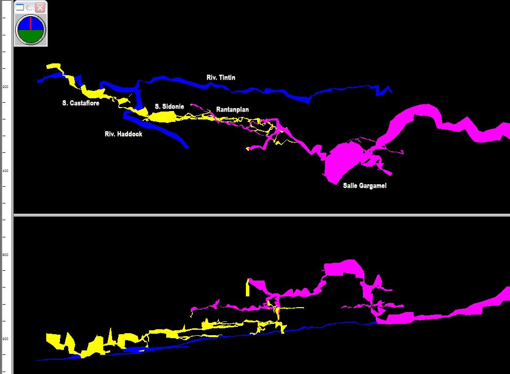
Paul De Bie